
Jean Cemetery
Douglas County
Jean, WA 98830
Lat: 47º 49′ 46″ N, Lon: 119º 29′ 25″ W
T27N R26E Sec 24
Last edited Oct 25, 2004.
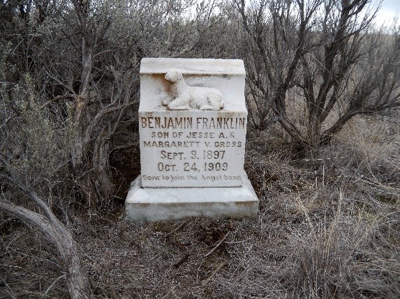
Located 6 miles east of Mansfield High School on Highway 127. Turn north on Rd K NE (a.k.a. Six Mile Road). After one mile, turn east on a primitive Rd 15 NE. After one mile you come to the intersection of Rd 15 NE and Rd L NE. The cemetery is in the southwest corner, an area of at least 4 acres – sagebrush. The stones of the graves are spread out all over. I don’t know if there are any records of unmarked graves.
Most of the above have obits on file at the WAGS library in Wenatchee.
Fred Pflugrath finished walking the cemetery on June 24, 1998. From the appearance, I doubt if anyone had been there in sometime. The sagebrush in some areas is at least 4 feet tall. I am sure I missed some gravestones and did have the feeling that there were unmarked graves. I asked in Mansfield and no one knew who had the cemetery records – if there ever were any.
The table SEARCH box filter on the top right can be used to search for data in ANY column.
Use the Custom Search Builder ‘Add Condition’ button above the data table to search (filter) data in any or all column(s) of the data table. You select the columns needed to limit your search. Use the Clear ‘X’ or ‘Clear All’ button to clear out any prior custom search text you have entered to start over. You must manually clear the normal Search box by clicking the ‘X’ in the box.
No need to use ‘wildcard’ characters in your search, the filters do that automatically. Therefore, don’t put too much info into either of the search boxes; it could cause nothing to be found. Start with just a few characters in the search boxes.
Click the ‘Name’ column which has the ‘+’ sign on the left to better view data for that row in a dialog box window rather than the wrapped text in each cell of the table.
You can PRINT, download in CSV format, view a PDF, or copy to the clipboard the displayed records.
Use the ‘Show Entries’ pulldown to control how many rows of data to display on each page. Always check the print preview and verify the number of pages you want to print.
Jean Cemetery
| NAME | BIRTH Date | BIRTH PLACE | DEATH DATE | DEATH PLACE | GRAVE LOCATION | COMMENTS | CEMETERY | LOCATION IN LIBRARY | AGE | ID No | SEX | VET | SERVICE | ARRANGER OWNER | FUNERAL HOME | MARKER | PLAT BK No | YEAR | Find A Grave | DbIndx (key) |
|---|---|---|---|---|---|---|---|---|---|---|---|---|---|---|---|---|---|---|---|---|
| NAME | BIRTH Date | BIRTH PLACE | DEATH DATE | DEATH PLACE | GRAVE LOCATION | COMMENTS | CEMETERY | LOCATION IN LIBRARY | AGE | ID No | SEX | VET | SERVICE | ARRANGER OWNER | FUNERAL HOME | MARKER | PLAT BK No | YEAR | Find A Grave | DbIndx (key) |