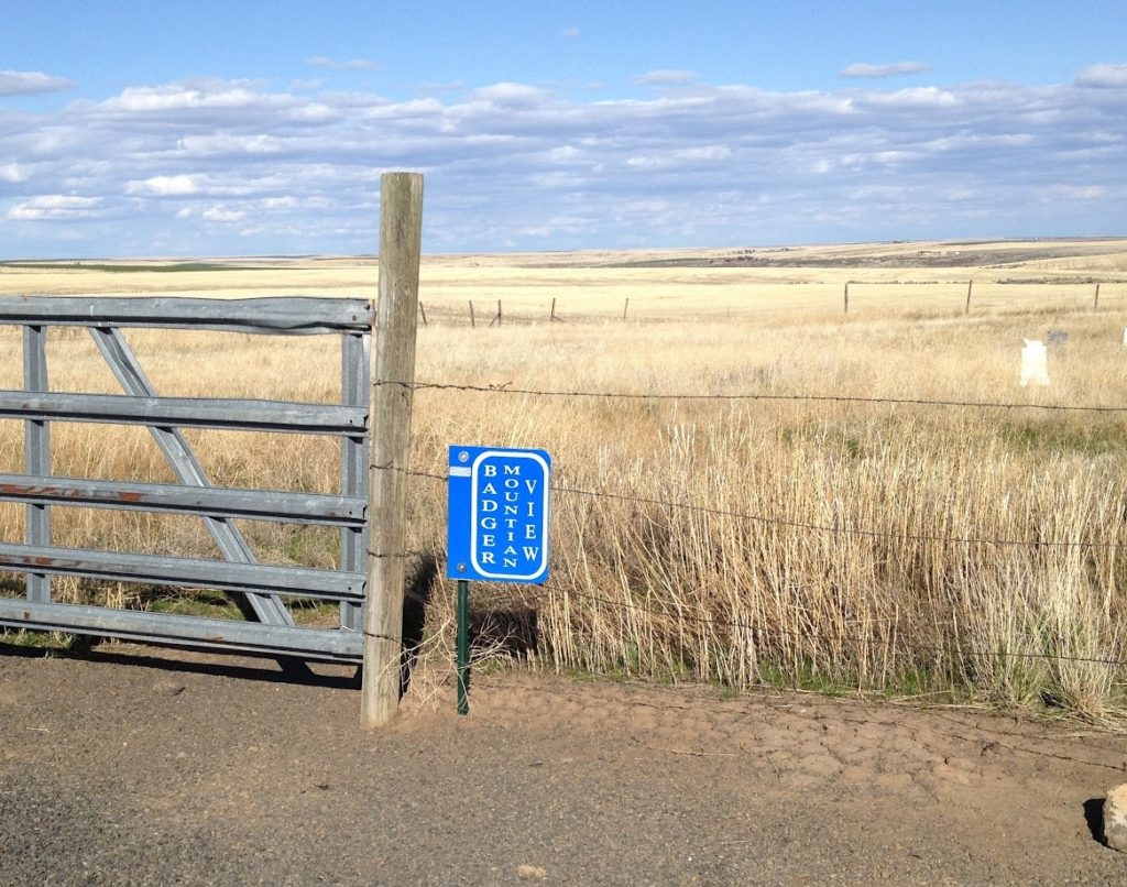
Badger Mountain View Cemetery aka Robbins
Douglas County, Waterville, WA 98858
Lat: 47º 36′ 32″ N, Lon: 120º 02′ 48″ W T24N R22E SEC 2
Contributed by Fred Pflugrath Sep 23, 2000; last updated 2015.
From St. Joseph’s Catholic Church in Waterville, go straight south on Chelan Avenue for about 2.5 miles. The paved county road changes name to Rd O SW, Badger Mountain Rd. You come to a T in the road where right/west goes to the Waterville Ski Hill, but you turn left/east on Baseline and go about .75 miles and turn slight right on Rd 1 SE/Waterville South Road. The cemetery is located about .1 miles on the east side of the county road. Fred Pflugrath walked the cemetery on 6 November 1998 and 8 November 2001.
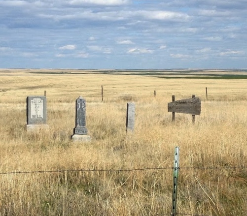
The stones in the cemetery have two spellings: Knuver and Kneever. There are at least a half dozen graves without stones. Most have obituaries on file at the WAGS Library in Wenatchee.
Badger Mountain View Cemetery aka Robbins
See Search instructions below the table.
| NAME | BIRTH Date | BIRTH PLACE | DEATH DATE | DEATH PLACE | GRAVE LOCATION | COMMENTS | CEMETERY | LOCATION IN LIBRARY | AGE | ID No | SEX | VET | SERVICE | ARRANGER OWNER | FUNERAL HOME | MARKER | PLAT BK No | YEAR | Find A Grave | DbIndx (key) |
|---|---|---|---|---|---|---|---|---|---|---|---|---|---|---|---|---|---|---|---|---|
| NAME | BIRTH Date | BIRTH PLACE | DEATH DATE | DEATH PLACE | GRAVE LOCATION | COMMENTS | CEMETERY | LOCATION IN LIBRARY | AGE | ID No | SEX | VET | SERVICE | ARRANGER OWNER | FUNERAL HOME | MARKER | PLAT BK No | YEAR | Find A Grave | DbIndx (key) |